Occupation du sol - Parc Naturel Régional du Vercors - 1994
Base thématique d'occupation des sols pour le territoire du Parc Naturel Régional du Vercors réalisés en 2006 pour l'année 1994.
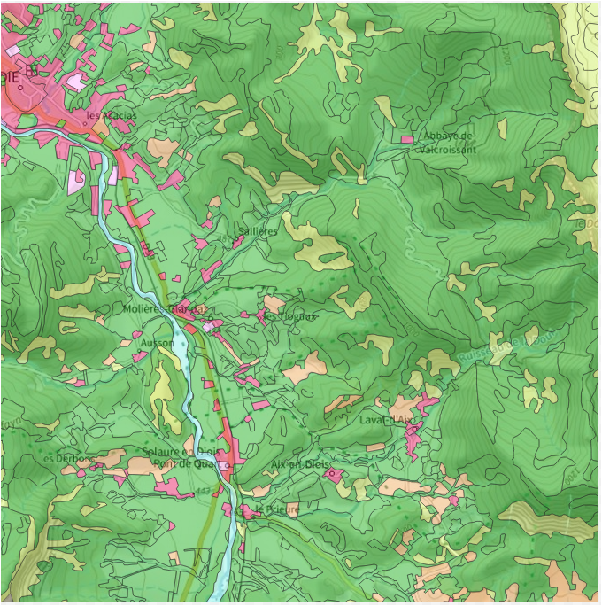
La taille de prise en compte du plus petit polygone isolé est 100m de côté. L'échelle de travail est le 10 000 ème. Ces données ont été photo interprétées à partir des images SPOT 5 et SPOT 2.
Réalisation confiée à SIRS sas
Simple
- Date (Creation)
- 2006
- Date (Publication)
- 2024-07-24
- Citation identifier
- http://www.parc-du-vercors.fr/occ_sol_1994
- Presentation form
- Digital map
- Status
- Completed
- Point of contact
-
Organisation name Individual name Electronic mail address Role Parc naturel régional du Vercors (PNR Vercors)
Point of contact
- Maintenance and update frequency
- As needed
- Place
-
-
vercors
-
parc du vercors
-
- Theme
-
-
open data
-
données ouvertes
-
PNR du Vercors
-
occupation des sols
-
parc naturel régional du Vercors
-
OCS
-
- Use limitation
-
Utilisation libre sous réserve de mentionner la source (a minima le nom du producteur) et la date de sa dernière mise à jour :"PNR Vercors 1994"
- Use limitation
-
Données ouvertes
- Access constraints
- Other restrictions
- Use constraints
- License
- Use constraints
- Other restrictions
- Other constraints
-
Pas de restriction d’accès public
- Other constraints
-
https://www.etalab.gouv.fr/wp-content/uploads/2017/04/ETALAB-Licence-Ouverte-v2.0.pdf
- Spatial representation type
- Vector
- Denominator
- 10000
- Language
-
fre
- Character set
- UTF8
- Topic category
-
- Environment
- Imagery base maps earth cover
))
- Unique resource identifier
- EPSG:2154
- Distribution format
-
Name Version ESRI Shapefile
1.0
- Distributor contact
-
Organisation name Individual name Electronic mail address Role Non précisé
Resource provider
- OnLine resource
-
Protocol Linkage Name WWW:DOWNLOAD-1.0-http--download
https://ids.craig.fr/geocat/srv/api/records/128f97ed-b195-4837-bfb6-cd9f580c93d3/attachments/rapport-final-vercors-os1994-2005-sirs.odt rapport-final-vercors-os1994-2005-sirs.odt
WWW:DOWNLOAD:ESRI Shapefile
https://ids.craig.fr/geocat/srv/api/records/128f97ed-b195-4837-bfb6-cd9f580c93d3/attachments/PNRV_1994_OCS_VERCORS.zip PNRV_1994_OCS_VERCORS.zip
OGC:WMS
https://ids.craig.fr/wxs/public/wms? PNRV_1994_OCS_VERCORS
OGC:WFS
https://ids.craig.fr/wxs/public/wms? PNRV_1994_OCS_VERCORS
- Hierarchy level
- Dataset
Conformance result
- Date (Publication)
- 2013-10-21
- Pass
- Non
- Statement
-
A partir de 6 scènes des satellites SPOT 2 et SPOT 3 puis orthorectification par la prise de points d’appuis sur l’orthophotoplan de 2002 à 50 cm de résolution.
Métadonnées
- File identifier
- 128f97ed-b195-4837-bfb6-cd9f580c93d3 XML
- Metadata language
-
fre
- Character set
- UTF8
- Hierarchy level
- Dataset
- Date stamp
- 2024-07-22T09:05:49.207018754Z
- Metadata standard name
-
ISO 19115:2003/19139
- Metadata standard version
-
1.0
- Metadata author
-
Organisation name Individual name Electronic mail address Role Parc naturel régional du Vercors (PNR Vercors)
Point of contact
Aperçus
Étendue spatiale
Fourni par
