Secteurs plans topographiques - CA Vichy Communauté- 2025
Secteurs de disponibilité de plans topographiques très grande échelle (1/200,1/500...)
Simple
- Date (Publication)
- 2014-05-14T10:00:00
- Date (Creation)
- 2010-01-13
- Date (Revision)
- 2025-05-05
- Citation identifier
- FR-24000426-plan_topo
- Presentation form
- Digital map
- Status
- Completed
- Point of contact
- 
                            Organisation name Individual name Electronic mail address Role Vichy Communauté Service SIG Owner Vichy Communauté Service SIG Point of contact 
- Maintenance and update frequency
- As needed
- Theme
- 
                            - 
                                  
                                    
                                    plan topo 
- 
                                  
                                    
                                    CA Vichy Communauté 
- 
                                  
                                    
                                    open data 
- 
                                  
                                    
                                    données ouvertes 
 
- 


- 
                            
                              
                              GEMET - INSPIRE themes, version 1.0 
- 
                            - 
                                  
                                    
                                    Altitude 
 
- 


- Use limitation
- 


                              Utilisation libre sous réserve de mentionner la source (a minima le nom du producteur) et la date de sa dernière mise à jour 
- Access constraints
- Other restrictions
- Use constraints
- License
- Other constraints
- 


                              Licence Ouverte v2.0 
- Spatial representation type
- Vector
- Denominator
- 5000
- Language
- 


                              fre 
- Character set
- UTF8
- Topic category
- 
                            - Imagery base maps earth cover
 
- Description
- 


                              CA Vichy Communauté 
                            
                            N


                            S


                            E


                            W
                          
                          )) 
                        - Reference system identifier
- EPSG / RGF93 / Lambert-93 (EPSG:2154) / 7.4
- Distribution format
- 
                            Name Version ESRI Shapefile 1.0 
- Distributor contact
- 
                            Organisation name Individual name Electronic mail address Role CRAIG 
- OnLine resource
- 
                            Protocol Linkage Name WWW:LINK-1.0-http--link https://www.vichy-communaute.fr/ WWW:DOWNLOAD:ESRI Shapefile https://ids.craig.fr/geocat/srv/api/records/83c752bf-68ed-4a97-9dae-eba0f1efd9d0/attachments/CA_VICHY_2025_secteur_plan_topo.zip CA_VICHY_2025_secteur_plan_topo.zip OGC:WMS https://ids.craig.fr/wxs/public/wms? CA_VICHY_2025_secteur_plan_topo OGC:WFS https://ids.craig.fr/wxs/public/wms? CA_VICHY_2025_secteur_plan_topo 
- Hierarchy level
- Dataset
Conformance result
- Date (Publication)
- 2010-10-23
- Explanation
- 


                                  Non Evalué 
- Pass
- Non
- Statement
- 


                              Saisie de l'emprise des plans topographiques sur fond cadastre 
Métadonnées
- File identifier
- 83c752bf-68ed-4a97-9dae-eba0f1efd9d0 XML
- Metadata language
- 


                              fre 
- Character set
- UTF8
- Hierarchy level
- Dataset
- Date stamp
- 2025-05-12T08:16:43.544485889Z
- Metadata standard name
- 


                              ISO 19115:2003/19139 
- Metadata standard version
- 


                              1.0 
- Metadata author
- 
                            Organisation name Individual name Electronic mail address Role Vichy Communauté Service SIG Point of contact 
Aperçus
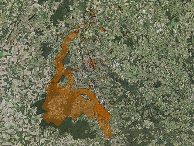
 
                    large_thumbnail
                  Étendue spatiale
                      
                      N


                      S


                      E


                      W
                    
                    )) 
                  Fourni par
 
                Ressources associées
Not available